Topographic Data Analysis of Observed Wind Data Recorded at 15 Different Stations in Thailand
DOI:
https://doi.org/10.37934/arfmts.92.2.116137Keywords:
Wind speed, power density, anemometer, roughnessAbstract
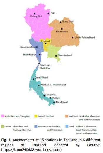
This study focuses on the collection and observation of mean wind speed and power density of 15 stations in Thailand merged with the topographic map of the stations. The wind data was collected by installing anemometers at 10m, 15m, 20m,25m and 30m height at 15 selected stations around Thailand. Wind Analysis and Application Program (WAsP) is used to generate mean wind speed and power density. Meanwhile, roughness and surface elevation map are produced and merged with the data in WAsP. The results showed the highest wind speed in Songkhla station which was 3.16 to 12.15m/s and on the other hand data from Narathiwat showed the lowest mean wind ranging from 1.13 to 1.72m/s. Finally, Songkhla station power density ranges from 24-1372W/m2 and in Narathiwat station ranging from 2-5W/m2 in terms of power density. In Thailand, the landscape is diverse such as plateau, plains, coastal plains, land, mountains, mountain ranges and hills. Generally, the wind speeds and directions change due to landscape. For this season, to study wind resource, investigation on topography is vital.
Downloads


