Risk Management of Coastal Ring Roads to Rate Abrasion on the Lhokseumawe City
DOI:
https://doi.org/10.37934/araset.39.1.168182Keywords:
Risk Management, Topography, Abrasion, Ring roadsAbstract
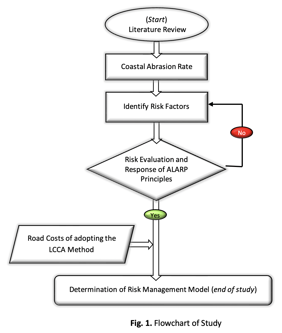
This paper presents an approach for developing risk management strategies for ring roads in coastal abrasion Lhokseumawe ring roads. Currently, management strategies in these regions are designed to rubble mount breakwaters on coastal performance under traffic loads. However, recent large-scale waves and their associated damage to coastal areas have demonstrated the need to consider the height when making coastal management decisions. This paper aims to develop a risk management strategy that includes handling/controlling accelerated beach abrasion which damages coastal infrastructure buildings and the application of the ALARP scheme as an acceptable risk control limit for decision makers in risk management so as to minimize the potential impact at any given time... The methods consider the rate of coastal abrasion associated with hazards and the economic, social, and environmental consequences of collapse under high tide. The data were collected from the satellite Landsat range of the 1995-2021 year. The analysis adopted Digital Shoreline Analysis System with Enhanced Thematic Mapper (ETM). The risk management strategies are achieved by formulating and solving a multi-objective optimization problem. This problem's findings include abrasion -2.11 m/year and accretion maximum at 111.34 m or 4.45%. The height of the wave was found approximately range 2.33-10.25 sec, and the period average 4.57 m/year. In addition, the periods of the wave were in the range of 2.33-10.25 sec, and the average period was 4.57 sec. The topography characteristics were found between 0 and 8.60 meters, with an average level, is 4.30 meters. The percentage of the slope of the shoreline was found to be 2.90 to 4.47%, and the average beach slope was 3.76%. The risk management achieved in ring roads was relevant to the application scheme ALARP zone to solve the problem from very high to hight risk. The rubble mound breakwaters along the coast were believed to minimize abrasion and mitigate disasters to protect infrastructure ring roads for a long time.
Downloads
Downloads
Published
How to Cite
Issue
Section