Spatial and Temporal Water Pattern Change Detection through the Normalized Difference Water Index (NDWI) for Initial Flood Assessment: A Case Study of Kuala Lumpur 1990 and 2021
DOI:
https://doi.org/10.37934/arfmts.114.1.178187Keywords:
Surface water, spatial pattern, change detection, NASA_Landsat, Kuala LumpurAbstract
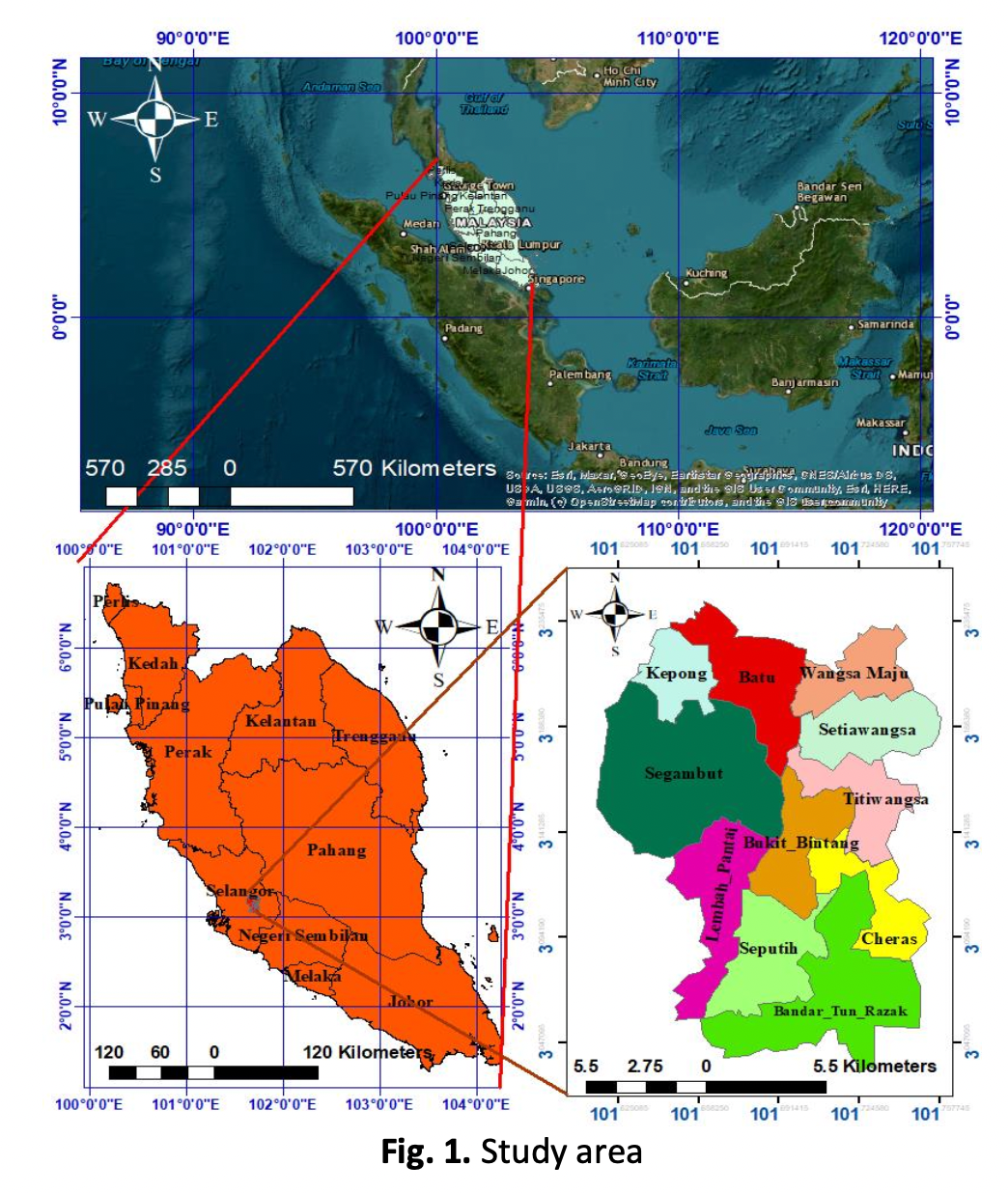
Surface water pattern changes in terms of quantity and directions is caused by many hydrological hazards such as flooding. Rapid urbanization in Kuala Lumpur has destroyed urban forest trees as the most valuable urban green infrastructure (UGI). Then surface, vegetation changes and land transformation, concrete roads, covered roofs, and climate changes impacts changed the water pattern and hydrological system in Kuala Lumpur. Satellite data used to collect data from 1990 and 2021 to show how significant has been these changes. To demonstrate the spatial and temporal changes of hydrological changes in Kuala Lumpur The Normalized Difference Water Index (NDWI) applied for a 30 years assessment. Remote sensing (RS) and Geographical Information Systems (GIS) have helped us detect dynamic changes on the Earth's surface. The mean NDWI of one year was calculated in this study using Kuala Lumpur NDWI from 1990/01/01 to 1990/12/30. The extracted image is larger than the study area and extends beyond Kuala Lumpur's city limits. This image only detected water bodies on the surface of Kuala Lumpur, which is represented in grey or white, such as lakes, rivers, ponds, or any degree of wetness. Because urban forest covered more than 15% of Kuala Lumpur in 1990, surface water was naturally controlled and saved by forest tree and forest soil. Image data for 2021 was taken from Landsat 8, which uses different bands and the same algorithm to visualize NDWI based on the availability of satellite data. The data was averaged over a one-year period between 2021/01/01 to 2021/12/30; as a result, the NDWI in Kuala Lumpur was depicted using the same algorithm from Landsat 8 with different bands. The researchers discovered that urban surface water bodies have increased over the last 30 years, rising from 0.383635 and -.0593184 in 1990 to 0.593288 and -0.44379 in 2021. This indicates that the NDWI index has increased the most in Kuala Lumpur. As previously stated, rapid changes in land use and land cover in the last 30 years have had a negative impact on Kuala Lumpur's NDWI.
Downloads
Downloads
Published
How to Cite
Issue
Section