Short-Term Shoreline Evolution Mapping by using UAV
DOI:
https://doi.org/10.37934/araset.41.1.113Keywords:
Shoreline, UAV Photogrammetry, Unmanned Aerial VehicleAbstract
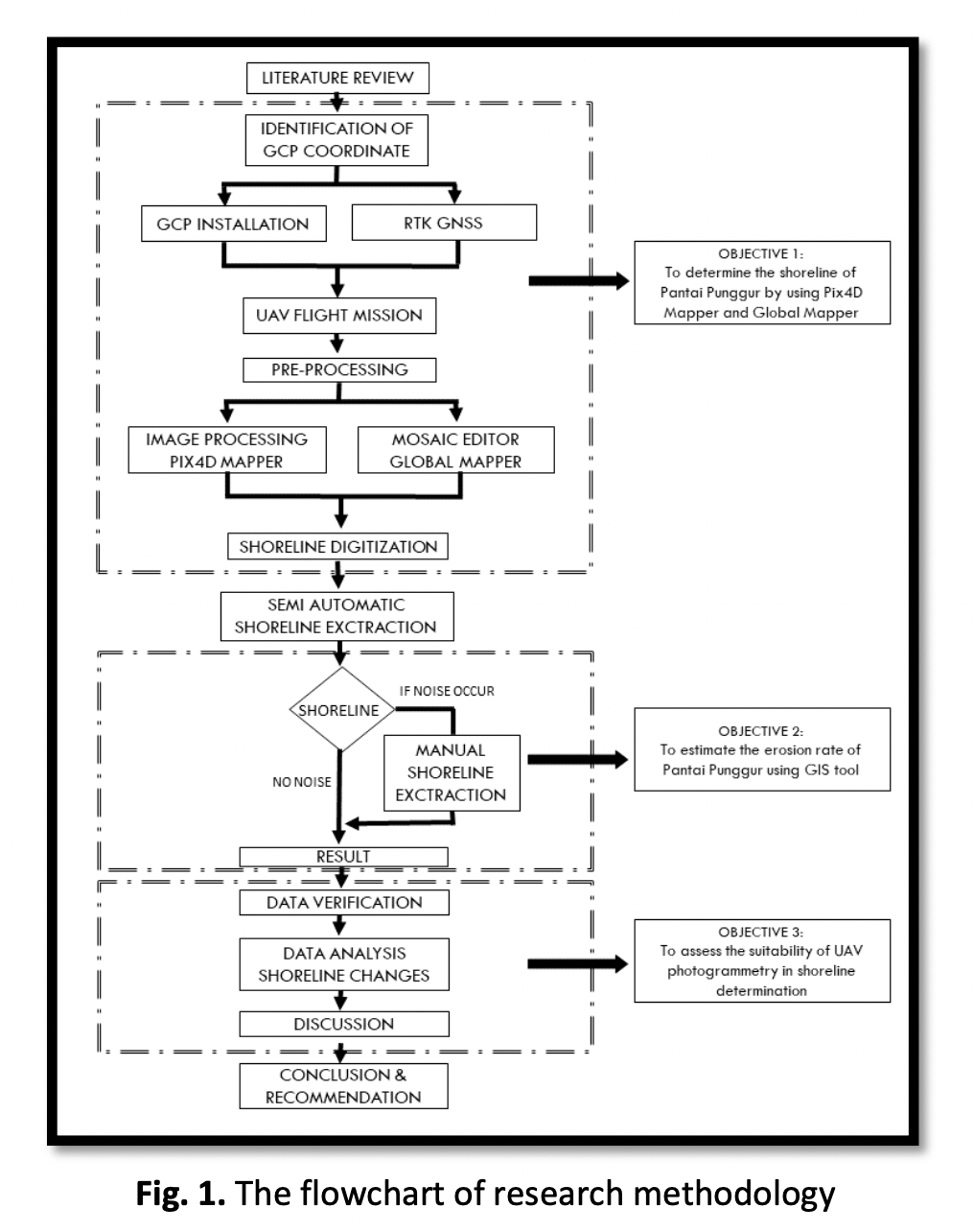
The boundary separating land from the beachside is known as the coastline. Monitoring and analysing shorelines are crucial because it gives us a better understanding of shoreline changes and identifies beach conditions. Unmanned aerial vehicle (UAV) or drone usage has emerged as a beneficial technology in coastal engineering, notably in the study of shoreline evolutions, because it is more credible and more straightforward to use than the prior technologies. This study aims to gather coastal data, evaluate Pantai Punggur shorelines, and track shoreline changes using processed imagery. The "Pix4D Capture" application has been programmed with the flight planning route, and the drone takes pictures along the entire grid line provided. The data on shoreline evolutions were processed using the Pix4d Mapper and Global Mapper tools. Shoreline changes were tracked continuously from August 4th, 2020, through August 10th, 2021. According to the results, Pantai Punggur is undergoing erosion, as evidenced by the alterations in the shoreline that were apparent in less than a year.Downloads
Download data is not yet available.
Downloads
Published
2024-03-04
How to Cite
Masiri Bin Kaamin, Mohammad Ikhmal Siddiq Bin Jefri Din, Mohd Effendi Bin Daud, Mardiha Binti Mokhtar, Muhamad Syamil Bin Sabri, & Effi Helmy Bin Ariffin. (2024). Short-Term Shoreline Evolution Mapping by using UAV. Journal of Advanced Research in Applied Sciences and Engineering Technology, 41(1), 1–13. https://doi.org/10.37934/araset.41.1.113
Issue
Section
Articles


